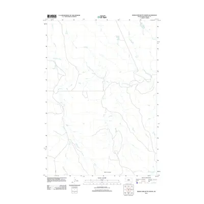
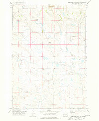
2012 Map of Deers Ears Butte North
USGS Topo · Published 2012About this map
Deers Ears Butte rises as a prominent landmark in the southeastern corner of this rangeland landscape, serving as a focal point for the surrounding high plains of Butte County. The area is defined by a dendritic drainage network where the S Fork Moreau River gathers waters from numerous seasonal tributaries. These waterways, including Warren Cr and Spring Cr in the west and Flat Cr and Horse Cr to the east, create a complex topography of draws and ridges typical of the Western South Dakota shortgrass prairie. Human presence is sparse, represented primarily by the winding track of Erk RD and a light network of local roads that follow the natural contours of the land. The mapping of numerous small stock ponds suggests a landscape deeply tied to cattle ranching, where water management is critical for the survival of livestock across the wide-open intervals between permanent creek flows.
Find a feature on this map
8 named features on this map. Tap any name to fly to it.
Don’t see what you’re looking for? This feature index may not catch every label — zoom into the map to look around manually.
Map Details
Editions of this 2012 Deers Ears Butte North Map
This is the sole edition of this map. No revisions or reprints were ever made.
Other maps of this area

1913 · Newell
USGS Topo · 1:125,000

1935 · Hoover
USGS Topo · 1:125,000

1953 · Rapid City
USGS Topo · 1:250,000

1954 · Lemmon
USGS Topo · 1:250,000

1957 · Lemmon
USGS Topo · 1:250,000

1957 · Rapid City
USGS Topo · 1:250,000
1973 · Deers Ears Butte North
USGS Topo · 1:24,000
1977 · Hoover
USGS Topo · 1:24,000
1977 · Granger Creek
USGS Topo · 1:24,000
1977 · Deers Ears Butte South
USGS Topo · 1:24,000