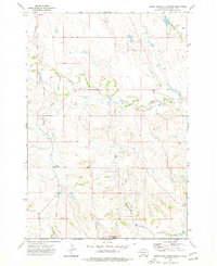
1973 Map of Deers Ears Butte North
USGS Topo · Published 1977About this map
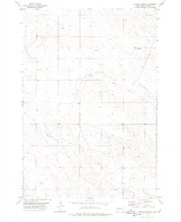
Deers Ears Butte anchors the southern boundary of this high plains landscape, a prominent landmark in a region defined by its complex drainage network. The South Fork Moreau River meanders across the central portion of the quadrangle, collecting numerous tributaries including Spring Creek, Warren Creek, and Flat Creek. This 1972 aerial survey reveals a sparsely populated ranching environment where essential infrastructure is centered on isolated structures and water sources. A Dakota Range School provides a rare point of community assembly in the northern reaches, while scattered technical markers like a Drill Hole and a Well indicate the ongoing exploration of subterranean resources. The terrain is characterized by the transition from open plateaus to the incised valleys carved by Horse Creek and Trail Creek, documenting the geographic isolation and utilitarian settlement patterns of Butte County during the early 1970s.
Find a feature on this map
10 named features on this map. Tap any name to fly to it.
Don’t see what you’re looking for? This feature index may not catch every label — zoom into the map to look around manually.
Map Details
Editions of this 1973 Deers Ears Butte North Map
This is the sole edition of this map. No revisions or reprints were ever made.
Other maps of this area

1913 · Newell
USGS Topo · 1:125,000

1935 · Hoover
USGS Topo · 1:125,000

1953 · Rapid City
USGS Topo · 1:250,000

1954 · Lemmon
USGS Topo · 1:250,000

1957 · Lemmon
USGS Topo · 1:250,000

1957 · Rapid City
USGS Topo · 1:250,000
1977 · Hoover
USGS Topo · 1:24,000
1977 · Granger Creek
USGS Topo · 1:24,000
1977 · Deers Ears Butte South
USGS Topo · 1:24,000
1978 · Sulphur Butte
USGS Topo · 1:24,000