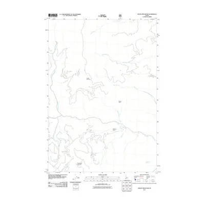
2011 Map of Degan Mountain
USGS Topo · Published 2011About this map
Degan Mountain and Sheephorn Mountain define this section of Lemhi County, characterized by a complex network of high-elevation drainages and basins. The presence of the Twin Peaks Mine in the northeastern quadrant suggests a history of resource extraction common to this part of Idaho. This 2011 survey illustrates how the landscape is segmented by significant watercourses like North Fork Iron Creek and South Fork Iron Creek, which converge as they flow toward the east. Isolated water sources such as Corbett Spring Number 1 and Sheephorn Spring are critical landmarks in this environment, while large alpine depressions like Badger Basin and Peel Tree Basin provide distinct geographical markers between the peaks. The map detail reflects the drainage patterns of Rattlesnake Creek and Deer Creek, illustrating the natural conduits through the mountains.
Find a feature on this map
19 named features on this map. Tap any name to fly to it.
Don’t see what you’re looking for? This feature index may not catch every label — zoom into the map to look around manually.
Map Details
Editions of this 2011 Degan Mountain Map
This is the sole edition of this map. No revisions or reprints were ever made.
Other maps of this area

1950 · Salmon
USGS Topo · 1:62,500

1950 · Leesburg
USGS Topo · 1:62,500

1951 · Leesburg
USGS Topo · 1:62,500

1951 · Salmon
USGS Topo · 1:62,500

1955 · Dubois
USGS Topo · 1:250,000

1955 · Dillon
USGS Topo · 1:250,000

1956 · Elk City
USGS Topo · 1:250,000

1957 · Dillon
USGS Topo · 1:250,000

1957 · Challis
USGS Topo · 1:250,000

1958 · Dubois
USGS Topo · 1:250,000