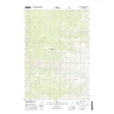
2017 Map of Degan Mountain
USGS Topo · Published 2017About this map
Salmon National Forest dominates this section of the Idaho backcountry, where steep drainages and high ridges dictate the movement of both modern travelers and those from earlier eras. The presence of the Old Indian Trail in the western portion of the map suggests a long history of transit through these mountains, predating the forest service roads that now navigate the terrain. Water sources are critical in this high-elevation landscape, marked by named points such as Sheephorn Spring and Corbett Spring Number 1. Significant peaks including Degan Mtn and Sheephorn Mtn overlook deep basins like Peel Tree Basin and Badger Basin. The map captures a network of specialized routes, from the industrial Haul Rd to various forest service tracks like Fork Off 083 D, reflecting the ongoing management and access requirements of this protected wilderness.
Find a feature on this map
29 named features on this map. Tap any name to fly to it.
Don’t see what you’re looking for? This feature index may not catch every label — zoom into the map to look around manually.
Map Details
Editions of this 2017 Degan Mountain Map
This is the sole edition of this map. No revisions or reprints were ever made.
Other maps of this area

1950 · Salmon
USGS Topo · 1:62,500

1950 · Leesburg
USGS Topo · 1:62,500

1951 · Leesburg
USGS Topo · 1:62,500

1951 · Salmon
USGS Topo · 1:62,500

1955 · Dubois
USGS Topo · 1:250,000

1955 · Dillon
USGS Topo · 1:250,000

1956 · Elk City
USGS Topo · 1:250,000

1957 · Dillon
USGS Topo · 1:250,000

1957 · Challis
USGS Topo · 1:250,000

1958 · Dubois
USGS Topo · 1:250,000