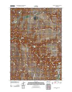
2011 Map of Degner Canyon
USGS Topo · Published 2011About this map
Paulina Butte rises above a high-desert landscape defined by complex drainage networks and deep canyons in this northern Oregon survey. The presence of Maupin Cemetery near the head of Little Trout Cr provides a specific point of genealogical interest in a region primarily shaped by rural land use. The terrain is marked by significant topographical features such as The Flatirons and the Paulina Basin, while water sources like Tub Springs, Kimsey Springs, and Degner Spring appear as vital landmarks in an otherwise arid environment.
Find a feature on this map
34 named features on this map. Tap any name to fly to it.
Don’t see what you’re looking for? This feature index may not catch every label — zoom into the map to look around manually.
Map Details
Editions of this 2011 Degner Canyon Map
This is the sole edition of this map. No revisions or reprints were ever made.
Other maps of this area

1955 · Bend
USGS Topo · 1:250,000

1957 · Bend
USGS Topo · 1:250,000

1958 · Bend
USGS Topo · 1:250,000

1966 · Antelope
USGS Topo · 1:62,500

1966 · Willowdale
USGS Topo · 1:62,500

1968 · Axehandle Butte
USGS Topo · 1:24,000

1968 · Ashwood
USGS Topo · 1:24,000
1969 · Teller Butte
USGS Topo · 1:24,000

1981 · Stephenson Mountain
USGS Topo · 1:100,000
1987 · Donnybrook
USGS Topo · 1:24,000