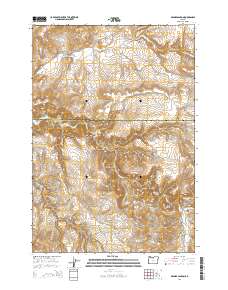
2014 Map of Degner Canyon
USGS Topo · Published 2014About this map
Pony Butte and Paulina Butte dominate the high-desert landscape along the boundary between Wasco and Jefferson counties. This 2014 survey captures a region defined by complex drainage systems and isolated landmarks, where the Maupin Cem serves as a lone genealogical marker near the south-eastern corner. The terrain is deeply incised by Degner Canyon, Kirkbride Canyon, and Forman Canyon, which channel seasonal waters toward larger systems like Trout Cr.
Find a feature on this map
36 named features on this map. Tap any name to fly to it.
Don’t see what you’re looking for? This feature index may not catch every label — zoom into the map to look around manually.
Map Details
Editions of this 2014 Degner Canyon Map
This is the sole edition of this map. No revisions or reprints were ever made.
Other maps of this area

1955 · Bend
USGS Topo · 1:250,000

1957 · Bend
USGS Topo · 1:250,000

1958 · Bend
USGS Topo · 1:250,000

1966 · Antelope
USGS Topo · 1:62,500

1966 · Willowdale
USGS Topo · 1:62,500

1968 · Axehandle Butte
USGS Topo · 1:24,000

1968 · Ashwood
USGS Topo · 1:24,000
1969 · Teller Butte
USGS Topo · 1:24,000

1981 · Stephenson Mountain
USGS Topo · 1:100,000
1987 · Donnybrook
USGS Topo · 1:24,000