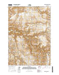
2017 Map of Degner Canyon
USGS Topo · Published 2017About this map
Paulina Butte and Paulina Basin anchor this high-elevation landscape in North Central Oregon, where the boundary between Wasco and Jefferson Counties bisects a network of deep drainages. The area is defined by complex topography, with Degner Canyon, Kirkbride Canyon, and Forman Canyon carving through the plateau toward the Trout Creek drainage. Significant for local family history, the Maupin Cem is situated in the southeastern corner near Long Hollow. A primitive road network, including Tub Springs Rd and NE Pony Butte Rd, connects remote landmarks such as Sheep Rock and The Flatirons. These names reflect an era of livestock grazing and early land claims, while features like Timber Culture Gulch hint at late 19th-century efforts to establish woodland in the arid interior.
Find a feature on this map
38 named features on this map. Tap any name to fly to it.
Don’t see what you’re looking for? This feature index may not catch every label — zoom into the map to look around manually.
Map Details
Editions of this 2017 Degner Canyon Map
This is the sole edition of this map. No revisions or reprints were ever made.
Other maps of this area

1955 · Bend
USGS Topo · 1:250,000

1957 · Bend
USGS Topo · 1:250,000

1958 · Bend
USGS Topo · 1:250,000

1966 · Antelope
USGS Topo · 1:62,500

1966 · Willowdale
USGS Topo · 1:62,500

1968 · Axehandle Butte
USGS Topo · 1:24,000

1968 · Ashwood
USGS Topo · 1:24,000
1969 · Teller Butte
USGS Topo · 1:24,000

1981 · Stephenson Mountain
USGS Topo · 1:100,000
1987 · Donnybrook
USGS Topo · 1:24,000