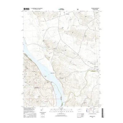
2016 Map of Dekoven
USGS Topo · Published 2016About this map
The Ohio River forms a major state boundary between Kentucky and Illinois, winding past the riverfront communities of Caseyville and Mulfordtown. This 2016 survey captures the intricate drainage patterns of the region, where the Tradewater River meets the Ohio and numerous man-made structures like Dennis O'Nan Ditch modify the landscape. The interior is characterized by a series of prominent elevations, including the Dyer Hills and Paris Hills, which contrast with the wetlands of Curlew Lakes and Wardens Slough.
Find a feature on this map
78 named features on this map. Tap any name to fly to it.
Don’t see what you’re looking for? This feature index may not catch every label — zoom into the map to look around manually.
Map Details
Editions of this 2016 Dekoven Map
This is the sole edition of this map. No revisions or reprints were ever made.
Other maps of this area

1907 · Morganfield
USGS Topo · 1:62,500

1909 · Providence
USGS Topo · 1:62,500

1916 · Shawneetown
USGS Topo · 1:62,500

1916 · Fords Ferry
USGS Topo · 1:62,500

1921 · Fords Ferry
USGS Topo · 1:48,000

1925 · Cave In Rock
USGS Topo · 1:62,500

1949 · Paducah
USGS Topo · 1:250,000

1949 · Morganfield
USGS Topo · 1:24,000

1950 · Paducah
USGS Topo · 1:250,000

1951 · Sturgis
USGS Topo · 1:24,000