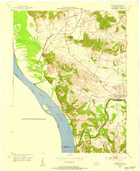
1953 Map of Dekoven
USGS Topo · Published 1954About this map
Ohio River bottomlands and the coal-rich interior of Union County define this early 1950s survey. The landscape is a mix of agricultural flats and prominent ridges like Paris Hills and Dodge Hills, which separate the river valley from the inland rail corridors. Small mining and river-oriented settlements such as Dekoven, Grangertown, and Caseyville are primary hubs of activity, linked by the Illinois Central and the private lines of the West Kentucky Coal Company.
Find a feature on this map
32 named features on this map. Tap any name to fly to it.
Don’t see what you’re looking for? This feature index may not catch every label — zoom into the map to look around manually.
Map Details
Editions of this 1953 Dekoven Map
This is the sole edition of this map. No revisions or reprints were ever made.
Other maps of this area

1907 · Morganfield
USGS Topo · 1:62,500

1909 · Providence
USGS Topo · 1:62,500

1916 · Shawneetown
USGS Topo · 1:62,500

1916 · Fords Ferry
USGS Topo · 1:62,500

1921 · Fords Ferry
USGS Topo · 1:48,000

1925 · Cave In Rock
USGS Topo · 1:62,500

1949 · Paducah
USGS Topo · 1:250,000

1949 · Morganfield
USGS Topo · 1:24,000

1950 · Paducah
USGS Topo · 1:250,000

1951 · Sturgis
USGS Topo · 1:24,000