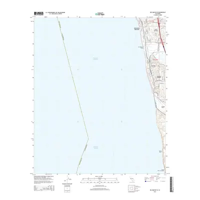
2015 Map of Del Mar OE W
USGS Topo · Published 2015About this map
Solana Beach and the coastal bluffs of Del Mar define this 2015 perspective of the North County shoreline. The map documents a densely developed suburban corridor where the San Dieguito River meets the Pacific Ocean, forming the broad San Dieguito Valley. Historic neighborhood enclaves like Eden Gardens and Del Mar Heights are shown in detail, gridded with local streets such as Via De La Valle and Jimmy Durante Blvd. Further south, the landscape transitions into the steep coastal topography of Soledad Valley and the expansive sands of Blacks Beach and Torrey Pines City Beach. This modern survey provides a precise record of late-twentieth-century residential growth and the preservation of coastal drainage basins and beach access points within the San Diego County boundary.
Find a feature on this map
57 named features on this map. Tap any name to fly to it.
Don’t see what you’re looking for? This feature index may not catch every label — zoom into the map to look around manually.
Map Details
Editions of this 2015 Del Mar OE W Map
This is the sole edition of this map. No revisions or reprints were ever made.
Other maps of this area

1893 · Oceanside
USGS Topo · 1:62,500

1893 · Escondido
USGS Topo · 1:62,500

1898 · Oceanside
USGS Topo · 1:62,500

1901 · Escondido
USGS Topo · 1:62,500

1901 · Oceanside
USGS Topo · 1:62,500

1901 · San Luis Rey
USGS Topo · 1:125,000

1903 · La Jolla
USGS Topo · 1:62,500

1904 · Southern California Sheet No. 2
USGS Topo · 1:250,000

1930 · La Jolla
USGS Topo · 1:62,500
1942 · Oceanside
USGS Topo · 1:62,500