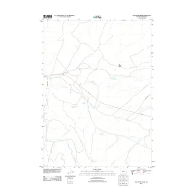
2012 Map of Del Monte Ridge
USGS Topo · Published 2012About this map
Del Monte Ridge dominates this high-altitude landscape in Fremont County, where water management is the primary human imprint on the terrain. The 2012 survey illustrates a network of essential water storage sites including Sevenmile Reservoir, Dobe Reservoir, and Del Monte Draw Reservoir. These catchments are linked by a complex drainage system fed by Twin Cr and its tributary Dry Twin Cr, alongside the southern waters of Red Bluff Cr. The map reveals a remote ranching and grazing environment where infrastructure is minimal, centered on a few primary routes like Twin Creek Rd and Beaver Creek Rd. This modern topographical record shows how these vital water resources are strategically positioned across the land to support livestock and land management in the arid Wyoming interior.
Find a feature on this map
14 named features on this map. Tap any name to fly to it.
Don’t see what you’re looking for? This feature index may not catch every label — zoom into the map to look around manually.
Map Details
Editions of this 2012 Del Monte Ridge Map
This is the sole edition of this map. No revisions or reprints were ever made.
Other maps of this area

1952 · Lander SE
USGS Topo · 1:24,000

1953 · Ninemile Hill
USGS Topo · 1:24,000

1953 · Bringolf Ranch
USGS Topo · 1:24,000

1953 · Gravel Spring
USGS Topo · 1:24,000

1953 · Schlichting Mountain
USGS Topo · 1:24,000

1953 · Del Monte Ridge
USGS Topo · 1:24,000

1953 · Yellowstone Ranch
USGS Topo · 1:24,000

1953 · Red Canyon
USGS Topo · 1:24,000

1953 · Weiser Pass
USGS Topo · 1:24,000

1955 · Lander
USGS Topo · 1:250,000