
1935 Map of Delacroix
USGS Topo · Published 1935About this map
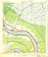
Bayou Terre Aux Boeufs meanders through this landscape of coastal marshes and intricate waterways, serving as the historical artery for settlements like Delacroix and Reggio. This 1935 survey, compiled from early aerial photography by the Air Corps, reveals the region's heavy reliance on drainage and transportation canals such as the Magnolia Canal, Kenilworth Canal, and Oliver Canal. These engineered waterways dissect the wetlands between the inland Lake Lery and the Gulf-facing marshes, illustrating the transition from natural bayous to a more managed hydrological system.
Find a feature on this map
25 named features on this map. Tap any name to fly to it.
Don’t see what you’re looking for? This feature index may not catch every label — zoom into the map to look around manually.
Map Details
Editions of this 1935 Delacroix Map
This is the sole edition of this map. No revisions or reprints were ever made.
Other maps of this area

1891 · Pointe a La Hache
USGS Topo · 1:62,500

1892 · St. Bernard
USGS Topo · 1:62,500

1892 · Pointe a La Hache
USGS Topo · 1:62,500

1893 · Shell Beach
USGS Topo · 1:62,500

1893 · Dime
USGS Topo · 1:62,500

1935 · Lake Batola
USGS Topo · 1:31,680

1939 · Shell Beach
USGS Topo · 1:62,500
1939 · Chalmette
USGS Topo · 1:31,680

1939 · Pointe a La Hache
USGS Topo · 1:62,500
1940 · Belle Chasse
USGS Topo · 1:31,680