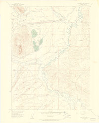
1955 Map of Delaney Butte
USGS Topo · Published 1957About this map
The North Fork North Platte River and its tributaries carve through this high Colorado ranching country, defined by an intricate network of irrigation systems essential to the local livestock economy. During the mid-1950s, the landscape was dotted with family-run operations including Briggs Ranch, Bohn Ranch, and Sorenson Ranch. The water management of the era is remarkably detailed, showing the Independent Ditch, Victor Ditch, and Bohn Ditch winding through the basin to support these remote outposts.
Find a feature on this map
56 named features on this map. Tap any name to fly to it.
Don’t see what you’re looking for? This feature index may not catch every label — zoom into the map to look around manually.
Map Details
Editions of this 1955 Delaney Butte Map
4 editions found
Other maps of this area

1911 · Hahns Peak
USGS Topo · 1:125,000

1913 · Hahns Peak
USGS Topo · 1:125,000

1954 · Craig
USGS Topo · 1:250,000

1955 · Lake John
USGS Topo · 1:24,000

1955 · Pitchpine Mountain
USGS Topo · 1:24,000

1955 · Teal Lake
USGS Topo · 1:24,000

1955 · Delaney Butte
USGS Topo · 1:24,000

1955 · Coalmont
USGS Topo · 1:24,000

1955 · Walden
USGS Topo · 1:24,000

1955 · Mac Farlane Reservoir
USGS Topo · 1:24,000