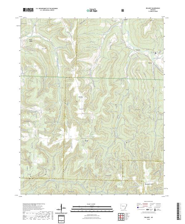
2024 Map of Delaney
USGS Topo · Published 2024About this map
Delaney and Patrick anchor this portion of the Boston Mountains, where the upper reaches of the White River and the Middle Fork White River carve deep into the Ozark Plateau. The terrain is defined by a dense network of ridges and hollows, including Skinner Hollow and Stringum Hollow, which dictate the paths of early county roads like Co RD 118 and State HWY 295. This landscape preserves the footprints of isolated rural life, from the scattered settlement at Brannon to the upland communities of Health and Mountain Crest.
Find a feature on this map
86 named features on this map. Tap any name to fly to it.
Don’t see what you’re looking for? This feature index may not catch every label — zoom into the map to look around manually.
Map Details
Editions of this 2024 Delaney Map
This is the sole edition of this map. No revisions or reprints were ever made.
Other maps of this area

1879 · Cravens
USGS Topo · 1:62,500

1887 · Watalula
USGS Topo · 1:62,500

1898 · Winslow #4
USGS Topo · 1:62,500

1898 · Winslow
USGS Topo · 1:125,000

1901 · Winslow
USGS Topo · 1:125,000

1939 · Watalula
USGS Topo · 1:62,500

1943 · St. Paul
USGS Topo · 1:62,500

1946 · St. Paul
USGS Topo · 1:62,500

1946 · Fort Smith
USGS Topo · 1:250,000

1956 · Russellville
USGS Topo · 1:250,000