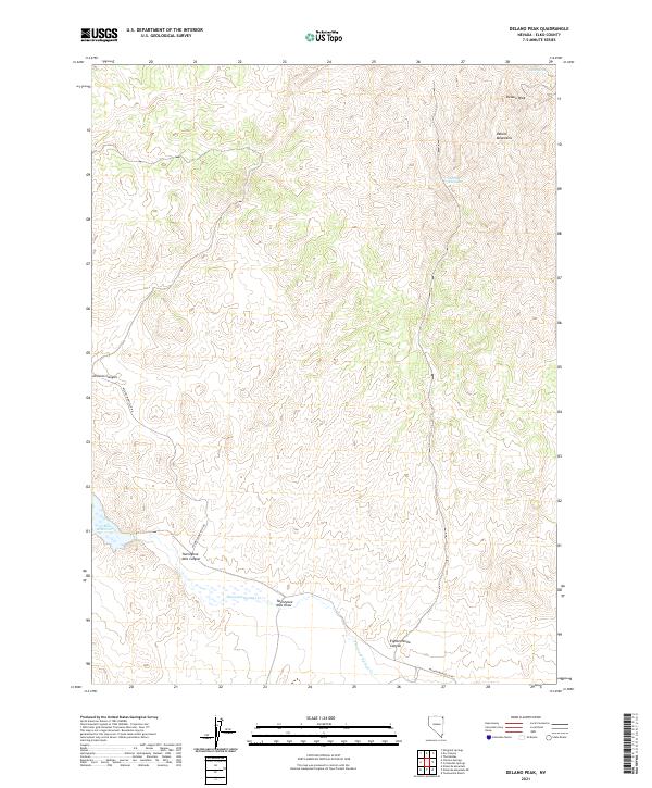
2021 Map of Delano Peak
USGS Topo · Published 2021About this map
The Delano Mountains dominate this high-desert landscape in Elko County, rising toward the prominent summit of Delano Peak. The terrain is defined by a series of dramatic drainages, including Division Canyon and the expansive Twentyone Mile Canyon, which descend toward the lower basins. Water management in this arid environment is evident through features like the 23 Mile Reservoir and the course of Thousand Springs Cr, which is fed by scattered sources such as Indian Spring and Eighteen Mile Spring. The Wilkins-Montello Rd provides the primary corridor through this isolated topography, tracing a path south of Twentyone Mile Draw and Eighteenmile Canyon. This U.S. Geological Survey representation highlights the complex relationship between elevation and essential water resources in the northeastern Great Basin.
Find a feature on this map
15 named features on this map. Tap any name to fly to it.
Don’t see what you’re looking for? This feature index may not catch every label — zoom into the map to look around manually.
Map Details
Editions of this 2021 Delano Peak Map
This is the sole edition of this map. No revisions or reprints were ever made.
Other maps of this area

1955 · Wells
USGS Topo · 1:250,000

1958 · Wells
USGS Topo · 1:250,000

1961 · Wells
USGS Topo · 1:250,000

1961 · Delano Mountains
USGS Topo · 1:62,500

1961 · Dairy Valley
USGS Topo · 1:62,500

1967 · Twelvemile Ranch
USGS Topo · 1:24,000

1967 · Ninemile Mtn NE
USGS Topo · 1:24,000

1967 · Ninemile Mtn
USGS Topo · 1:24,000
1980 · Dry Canyon
USGS Topo · 1:24,000
1981 · Wells
USGS Topo · 1:100,000