
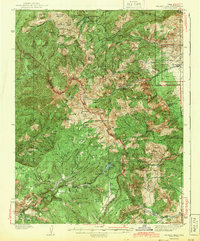
1943 Map of Delano Peak
USGS Topo · Published 1943About this map
Fishlake National Forest dominates the high-altitude landscape of south-central Utah in this early 1940s survey. The map centers on the high crest of the Tushar Mountains, including Delano Peak, Mt Belknap, and Mt Baldy. This era of public land management is represented by several remote outposts, including the Delano Ranger Station and Big Flat Guard Station, alongside shelters such as Telluride Cabin and Butler Beck Cabin.
Find a feature on this map
113 named features on this map. Tap any name to fly to it.
Don’t see what you’re looking for? This feature index may not catch every label — zoom into the map to look around manually.
Map Details
Editions of this 1943 Delano Peak Map
2 editions found
Other maps of this area

1885 · Beaver
USGS Topo · 1:250,000

1932 · Sevier
USGS Topo · 1:62,500

1935 · Sevier
USGS Topo · 1:62,500

1937 · Delano Peak
USGS Topo · 1:48,000

1940 · Monroe
USGS Topo · 1:62,500

1944 · Monroe
USGS Topo · 1:62,500

1945 · Marysvale
USGS Topo · 1:62,500

1947 · Marysvale
USGS Topo · 1:62,500

1953 · Richfield
USGS Topo · 1:250,000

1954 · Beaver SE
USGS Topo · 1:24,000