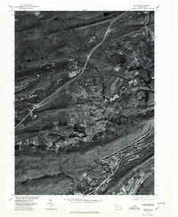
1976 Map of Delano
USGS Topo · Published 1979About this map
Delano and the surrounding coal region of Schuylkill County are captured in this orthophotograph, which emphasizes the heavy industrial footprint on the Pennsylvania landscape during the mid-1970s. The imagery reveals the complex relationship between residential settlements and the massive ridge-and-valley formations of Broad Mountain, Locust Mountain, and Sharp Mountain. In the valleys between these heights, towns like Quakake, Park Crest, and Tuscarora appear as distinct pockets of development. The course of the Schuylkill River and Quakake Creek cut through the terrain, while the aerial perspective clearly shows the impact of surface mining and transportation corridors, including the Interstate route crossing near Mary D. This visual record serves as a precise document of the region's land use before later reforestation and reclamation efforts altered these industrial scars.
Find a feature on this map
10 named features on this map. Tap any name to fly to it.
Don’t see what you’re looking for? This feature index may not catch every label — zoom into the map to look around manually.
Map Details
Editions of this 1976 Delano Map
This is the sole edition of this map. No revisions or reprints were ever made.
Other maps of this area

1889 · Hazleton
USGS Topo · 1:62,500

1889 · Pottsville
USGS Topo · 1:62,500

1891 · Hazleton
USGS Topo · 1:62,500

1891 · Pottsville
USGS Topo · 1:62,500

1892 · Mahanoy
USGS Topo · 1:62,500

1893 · Hazleton
USGS Topo · 1:62,500

1893 · Mahanoy
USGS Topo · 1:62,500

1909 · Hamburg
USGS Topo · 1:62,500

1911 · Hamburg
USGS Topo · 1:62,500

1944 · Pottsville
USGS Topo · 1:24,000
Featured Places
- Hometown, Rush Township
- Delano, Delano Township
- Schuylkill Township, PA
- Haucks, Rush Township
- Buck Mountain, Mahanoy Township