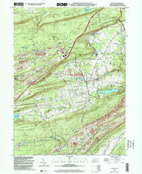
1999 Map of Delano
USGS Topo · Published 2001About this map
Schuylkill County's industrial and mountain landscape is defined here by the complex topography of the anthracite region, where the ridge-and-valley system of Mahanoy Mountain and Locust Mountain dictates the path of human settlement. The village of Delano sits at a critical junction of high-elevation plateaus and steep ravines, its history deeply entwined with the coal and rail industries. Evidence of the region’s extractive heritage is visible in the Strip Mine operations near Park Place and Trenton.
Find a feature on this map
65 named features on this map. Tap any name to fly to it.
Don’t see what you’re looking for? This feature index may not catch every label — zoom into the map to look around manually.
Map Details
Editions of this 1999 Delano Map
This is the sole edition of this map. No revisions or reprints were ever made.
Other maps of this area

1889 · Hazleton
USGS Topo · 1:62,500

1889 · Pottsville
USGS Topo · 1:62,500

1891 · Hazleton
USGS Topo · 1:62,500

1891 · Pottsville
USGS Topo · 1:62,500

1892 · Mahanoy
USGS Topo · 1:62,500

1893 · Hazleton
USGS Topo · 1:62,500

1893 · Mahanoy
USGS Topo · 1:62,500

1909 · Hamburg
USGS Topo · 1:62,500

1911 · Hamburg
USGS Topo · 1:62,500

1944 · Pottsville
USGS Topo · 1:24,000
Featured Places
- Hometown, Rush Township
- Delano, Delano Township
- Schuylkill Township, PA
- Haucks, Rush Township
- Buck Mountain, Mahanoy Township