2018 Map of Delano West
USGS Topo · Published 2018About this map
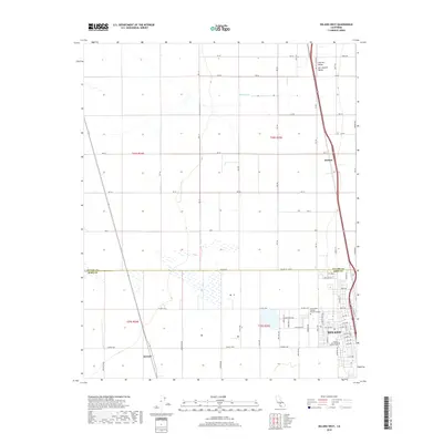
Delano anchors the southeastern corner of this survey, revealing a landscape defined by the geometric precision of the Central Valley agricultural grid. In the late 2010s, the area shows a high degree of land management, with section lines and county roads like Co Line Rd carving out the territory between the Tulare and Kern border. Education and community infrastructure are central to the town's footprint, notably the Bakersfield College - Delano Campus and the Delano McFarland District Cem. Beyond the city limits, the terrain transitions into the broader San Joaquin Valley, where the ephemeral course of the White River crosses the northern sections. Small rail-side or road-stop locations like Radnor and Kernell serve as quiet markers of the regional transportation and irrigation network that sustains this intensive farming district.
Find a feature on this map
74 named features on this map. Tap any name to fly to it.
Don’t see what you’re looking for? This feature index may not catch every label — zoom into the map to look around manually.
Map Details
Editions of this 2018 Delano West Map
This is the sole edition of this map. No revisions or reprints were ever made.
Other maps of this area

1927 · McFarland
USGS Topo · 1:31,680

1929 · Alpaugh
USGS Topo · 1:31,680

1929 · Delano
USGS Topo · 1:31,680

1929 · Sausalito School
USGS Topo · 1:31,680

1929 · Pixley
USGS Topo · 1:31,680

1929 · Stone
USGS Topo · 1:31,680

1929 · Allensworth
USGS Topo · 1:31,680

1930 · McFarland
USGS Topo · 1:31,680

1930 · Hamlin School
USGS Topo · 1:31,680

1930 · Pond
USGS Topo · 1:31,680