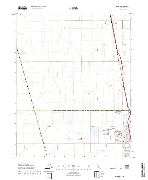
2021 Map of Delano West
USGS Topo · Published 2021About this map
Agricultural lands and industrial transport routes converge in this section of the San Joaquin Valley. The city of Delano anchors the southeastern corner, where the street grid expands westward toward the Delano McFarland District Cem and the Bakersfield College - Delano Campus. The landscape is defined by a rigid rectilinear road network, including long stretches of Ave 24 and Ave 16, which facilitate movement between rural outposts like Radnor and Kernell.
Find a feature on this map
74 named features on this map. Tap any name to fly to it.
Don’t see what you’re looking for? This feature index may not catch every label — zoom into the map to look around manually.
Map Details
Editions of this 2021 Delano West Map
This is the sole edition of this map. No revisions or reprints were ever made.
Other maps of this area

1927 · McFarland
USGS Topo · 1:31,680

1929 · Alpaugh
USGS Topo · 1:31,680

1929 · Delano
USGS Topo · 1:31,680

1929 · Sausalito School
USGS Topo · 1:31,680

1929 · Pixley
USGS Topo · 1:31,680

1929 · Stone
USGS Topo · 1:31,680

1929 · Allensworth
USGS Topo · 1:31,680

1930 · McFarland
USGS Topo · 1:31,680

1930 · Hamlin School
USGS Topo · 1:31,680

1930 · Pond
USGS Topo · 1:31,680