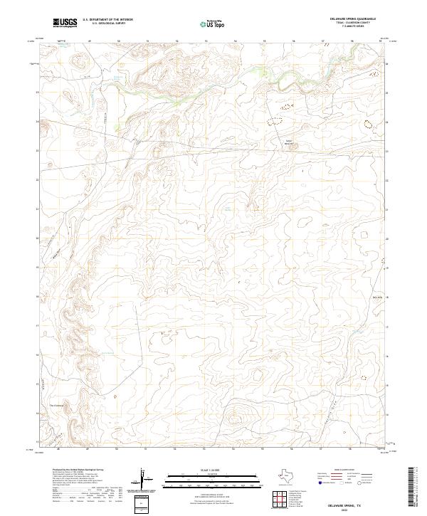
2022 Map of Delaware Spring
USGS Topo · Published 2022About this map
Delaware Springs and Delaware Spring anchor this high-desert landscape in Culberson County, where precious water sources once dictated the paths of travelers and surveyors alike. The terrain is defined by a series of intermittent drainages and draws, including Willow Draw, Chico Draw, and Castile Draw, which funnel seasonal runoff toward the Delaware River in the north. Notable topographic landmarks such as Sulfur Mine Hill, The Chimneys, and Twin Hills provide orientation across the arid expanse. The Presence of scattered water points like Cedar Spring, Burro Spring, and The Seep highlights the critical role of hydrology in this corner of the Trans-Pecos. Apart from FM 1108 and University Rd, the area remains largely undeveloped, preserving the original character of these isolated Texas landmarks.
Find a feature on this map
14 named features on this map. Tap any name to fly to it.
Don’t see what you’re looking for? This feature index may not catch every label — zoom into the map to look around manually.
Map Details
Editions of this 2022 Delaware Spring Map
This is the sole edition of this map. No revisions or reprints were ever made.
Other maps of this area

1954 · Van Horn
USGS Topo · 1:250,000

1958 · Van Horn
USGS Topo · 1:250,000

1973 · Seven L Peak
USGS Topo · 1:24,000

1973 · Seven L Peak NE
USGS Topo · 1:24,000

1973 · Chico Draw East
USGS Topo · 1:24,000

1973 · Cow Mountain
USGS Topo · 1:24,000

1973 · Delaware Spring
USGS Topo · 1:24,000
1973 · Castile Hill
USGS Topo · 1:24,000
1973 · Outlaw Spring
USGS Topo · 1:24,000
1973 · South Rector Canyon
USGS Topo · 1:24,000