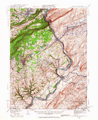
1941 Map of Delaware Water Gap
USGS Topo · Published 1941About this map
The Delaware River serves as the central artery of this 1941 survey, cutting through the gap between Mt Minsi and Mt Tammany. This landscape is defined by the sharp ridges of Kittatinny Mountain and Blue Mountain, which separate established hubs like Stroudsburg and East Stroudsburg from the agricultural valleys of New Jersey. The map documents a dense network of early 20th-century rural infrastructure, including a multitude of family-named schools such as Poplar Valley Sch, Hartzell Sch, and Miller Sch.
Find a feature on this map
135 named features on this map. Tap any name to fly to it.
Don’t see what you’re looking for? This feature index may not catch every label — zoom into the map to look around manually.
Map Details
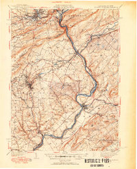
Editions of this 1941 Delaware Water Gap Map
This is the sole edition of this map. No revisions or reprints were ever made.
Historical Maps of East Stroudsburg Through Time
4 maps found