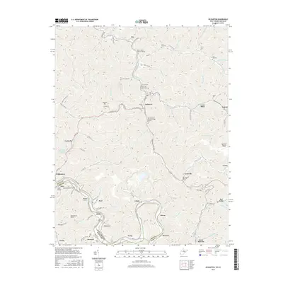
2016 Map of Delbarton
USGS Topo · Published 2016About this map
Pigeon Creek carves a path through the coal-rich mountains of Mingo County, defining the settlement patterns and industrial infrastructure of the region. The landscape is characterized by steep-walled hollows and ridges like Buffalo Mtn, where coal production is evidenced by the Lando Mines and the Cinderella Impoundment Number Two. The map details the central role of the Tug Fork valley, where the towns of Matewan and Williamson sit along the border of West Virginia and Kentucky. This area is connected by a network of memorial bridges, including the Rush T White Memorial Bridge and the Henry Hall Memorial Bridge. Genealogists will find numerous family burial grounds throughout the terrain, such as the Varney Cem and McCoy Cem, often situated on high ground above settlements like Red Jacket and Delbarton.
Find a feature on this map
104 named features on this map. Tap any name to fly to it.
Don’t see what you’re looking for? This feature index may not catch every label — zoom into the map to look around manually.
Map Details
Editions of this 2016 Delbarton Map
This is the sole edition of this map. No revisions or reprints were ever made.
Other maps of this area

1887 · Warfield
USGS Topo · 1:125,000

1891 · Warfield
USGS Topo · 1:125,000

1909 · Matewan
USGS Topo · 1:48,000

1910 · Holden
USGS Topo · 1:48,000

1910 · Naugatuck
USGS Topo · 1:48,000

1912 · Naugatuck
USGS Topo · 1:62,500

1912 · Holden
USGS Topo · 1:62,500

1915 · Williamson
USGS Topo · 1:48,000

1915 · Naugatuck
USGS Topo · 1:48,000

1915 · Matewan
USGS Topo · 1:48,000