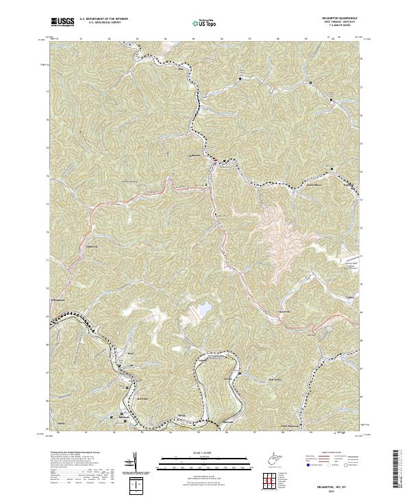
2023 Map of Delbarton
USGS Topo · Published 2023About this map
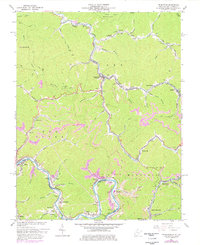
The Tug Fork river defines the southwestern boundary of this topographic survey, marking the border between West Virginia and Kentucky. The region is characterized by steep, narrow hollows and numerous small settlements that follow the winding paths of Pigeon Creek and its many tributaries. Coal mining heritage is evident in the presence of Lando Mines, while larger hubs like Matewan and Delbarton serve as the primary population centers. Significant family history sites are scattered throughout the hills, including the Sprigg Cem, Varney Cem, and Farley Cem. In addition to traditional river-and-rail industry, the modern footprint of the Southern West Virginia Regional Airport sits atop the high ground near Varney. The map also captures several distinct neighborhood labels such as Cinderella and Red Jacket, reflecting the deep-seated local identity of the Mingo County coalfields.
Find a feature on this map
100 named features on this map. Tap any name to fly to it.
Don’t see what you’re looking for? This feature index may not catch every label — zoom into the map to look around manually.
Map Details
Editions of this 2023 Delbarton Map
This is the sole edition of this map. No revisions or reprints were ever made.