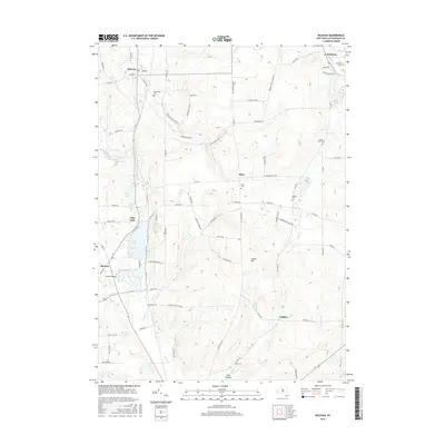
2016 Map of Delevan
USGS Topo · Published 2016About this map
Lime Lake serves as a central landmark in this portion of Cattaraugus County, flanked by the residential community of Lime Lake and the larger village of Machias. The landscape is defined by the winding course of Elton Cr and Ischua Cr, which carve through the terrain near the prominent Pigeon Hill. Significant for local historians and genealogists, the area is dotted with numerous burial grounds including Maplehurst Cem, Elton Cem, and Siloam Cem. Small settlements like Sandusky and Elton are connected by a network of rural routes such as Delevan Elton Rd and Hooper Corners RD. The map reveals a transition from the concentrated housing around the lakes to the high ground of Hog Hollow and the valley floors of Ischua Valley, reflecting a long history of water-dependent settlement and upland farming.
Find a feature on this map
92 named features on this map. Tap any name to fly to it.
Don’t see what you’re looking for? This feature index may not catch every label — zoom into the map to look around manually.
Map Details
Editions of this 2016 Delevan Map
This is the sole edition of this map. No revisions or reprints were ever made.
Other maps of this area

1923 · Arcade
USGS Topo · 1:62,500

1924 · Ellicottville
USGS Topo · 1:62,500

1924 · Franklinville
USGS Topo · 1:62,500

1925 · Springville
USGS Topo · 1:62,500

1925 · Arcade
USGS Topo · 1:62,500

1941 · Ellicottville
USGS Topo · 1:62,500

1942 · Franklinville
USGS Topo · 1:62,500

1957 · Sardinia
USGS Topo · 1:24,000

1960 · Buffalo
USGS Topo · 1:250,000

1962 · Buffalo
USGS Topo · 1:250,000