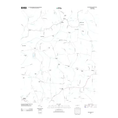
2013 Map of Dellrose
USGS Topo · Published 2013About this map
The Elk River carves a winding path through the center of this rural Tennessee landscape, defining the character of small settlements such as Dellrose and New Dellrose. This region is shaped by its proximity to the Alabama border, where the terrain transitions through numerous named hollows and hills, including Millville Hollow and Meetinghouse Hill. The area's industrial and transport history is evident in labels like Hamilton Mill and Morrell Mill, as well as the specialized rail infrastructure near Sinking Creek, where the Luda Tunnel and Luda Siding are situated. To the south, Cash Point and Blanche serve as focal points for local road networks, while the presence of Elkmont Springs suggests the importance of local water sources to early development. Genealogists may find value in tracing family names preserved in landmarks such as Whitt Hill and the Eagin Cemetery Road.
Find a feature on this map
135 named features on this map. Tap any name to fly to it.
Don’t see what you’re looking for? This feature index may not catch every label — zoom into the map to look around manually.
Map Details
Editions of this 2013 Dellrose Map
This is the sole edition of this map. No revisions or reprints were ever made.
Other maps of this area

1888 · Huntsville
USGS Topo · 1:125,000

1892 · Huntsville
USGS Topo · 1:125,000

1936 · Taft
USGS Topo · 1:24,000

1936 · Boonshill
USGS Topo · 1:24,000

1936 · Elkmont
USGS Topo · 1:24,000

1936 · Ardmore
USGS Topo · 1:24,000

1936 · Toney
USGS Topo · 1:24,000

1936 · Tarpley
USGS Topo · 1:24,000

1936 · Elkton
USGS Topo · 1:24,000

1936 · Frankewing
USGS Topo · 1:24,000