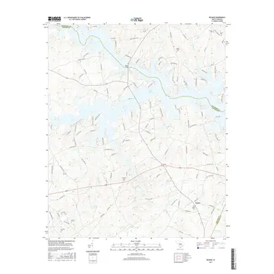
2017 Map of Delmar
USGS Topo · Published 2017About this map
Lake Murray dominates the northern landscape of this region, its irregular fingers reaching into the surrounding terrain near the Newberry and Saluda county line. The crossing at Blacks Bridge serves as a vital link over the water, connecting a network of residential and rural roads like Pierce Boozer Loop and Bonner Baxter Road. South of the lake, the settlement of Delmar sits at a junction of local routes, surrounded by a high density of small family and community burial grounds that provide a clear record of local lineage. These include Mount Hebron Cem, Nazareth Cem, and multiple locations of Matthews Cem. The interior landscape is drained by numerous small waterways such as Clouds Creek and Rocky Creek, with several impoundments including Vances Pond and Halls Pond scattered across the basin.
Find a feature on this map
108 named features on this map. Tap any name to fly to it.
Don’t see what you’re looking for? This feature index may not catch every label — zoom into the map to look around manually.
Map Details
Editions of this 2017 Delmar Map
This is the sole edition of this map. No revisions or reprints were ever made.
Other maps of this area

1904 · Columbia
USGS Topo · 1:125,000

1941 · Spartanburg
USGS Topo · 1:250,000

1944 · Gilbert
USGS Topo · 1:62,500

1953 · Spartanburg
USGS Topo · 1:250,000

1954 · Augusta
USGS Topo · 1:250,000

1957 · Augusta
USGS Topo · 1:250,000

1958 · Augusta
USGS Topo · 1:250,000

1960 · Spartanburg
USGS Topo · 1:250,000

1961 · Augusta
USGS Topo · 1:250,000

1962 · Augusta
USGS Topo · 1:250,000