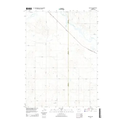
2014 Map of Deloit NE
USGS Topo · Published 2014About this map
The Elkhorn River and its South Fork meander across this landscape along the border of Holt and Antelope Counties. This 2014 survey documents a rural environment shaped by the path of the Chicago and N Western RR, which cuts diagonally across the northern portion of the quadrangle. Parallel to this rail line, the Cowboy Trl offers a contemporary recreational route through the same historic transportation corridor.
Find a feature on this map
24 named features on this map. Tap any name to fly to it.
Don’t see what you’re looking for? This feature index may not catch every label — zoom into the map to look around manually.
Map Details
Editions of this 2014 Deloit NE Map
This is the sole edition of this map. No revisions or reprints were ever made.
Other maps of this area

1955 · O'Neill
USGS Topo · 1:250,000

1959 · O'Neill
USGS Topo · 1:250,000

1963 · Deloit
USGS Topo · 1:24,000

1963 · Ewing SW
USGS Topo · 1:24,000

1963 · Deloit SW
USGS Topo · 1:24,000

1963 · Neligh SW
USGS Topo · 1:24,000

1963 · Orchard
USGS Topo · 1:24,000

1963 · Ewing
USGS Topo · 1:24,000

1963 · Deloit NE
USGS Topo · 1:24,000
1963 · Clearwater
USGS Topo · 1:24,000