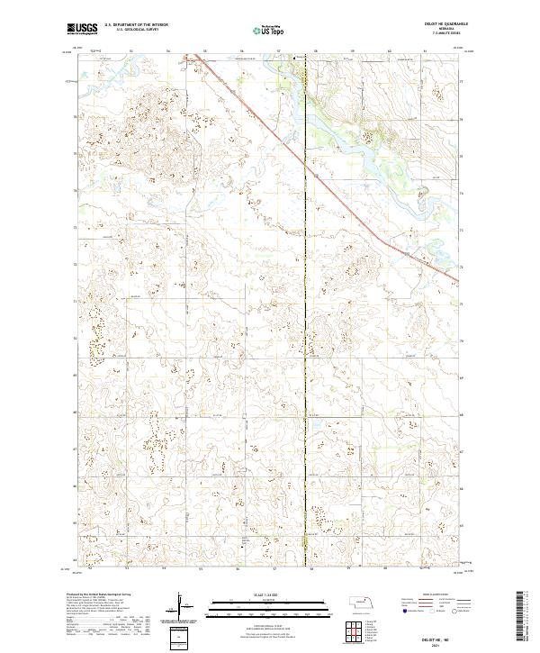
2021 Map of Deloit NE
USGS Topo · Published 2021About this map
The South Fork Elkhorn River and the Elkhorn River converge in this northern Nebraska landscape, defining a terrain shaped by the slow movement of water through the Sandhills region. The boundary between Holt Co and Antelope Co runs vertically through the center of the map, marking a quiet agricultural frontier. A prominent diagonal corridor is formed by the Cowboy Trl, a recreational path following a historic rail alignment that once connected the small settlements of the upper Elkhorn valley. Local history is anchored by the Ewing Cem in the north and Saint Patricks Cem to the south, reflecting the community heritage of the surrounding rural townships. Tributaries like Cache Cr wind through the sections, highlighting the drainage patterns essential to the ranching and farming operations that dominate this part of the state.
Find a feature on this map
31 named features on this map. Tap any name to fly to it.
Don’t see what you’re looking for? This feature index may not catch every label — zoom into the map to look around manually.
Map Details
Editions of this 2021 Deloit NE Map
This is the sole edition of this map. No revisions or reprints were ever made.
Other maps of this area

1955 · O'Neill
USGS Topo · 1:250,000

1959 · O'Neill
USGS Topo · 1:250,000

1963 · Deloit
USGS Topo · 1:24,000

1963 · Ewing SW
USGS Topo · 1:24,000

1963 · Deloit SW
USGS Topo · 1:24,000

1963 · Neligh SW
USGS Topo · 1:24,000

1963 · Orchard
USGS Topo · 1:24,000

1963 · Ewing
USGS Topo · 1:24,000

1963 · Deloit NE
USGS Topo · 1:24,000
1963 · Clearwater
USGS Topo · 1:24,000