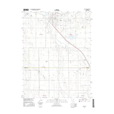
2016 Map of Delta
USGS Topo · Published 2016About this map
The confluence of the Gunnison River and Uncompahgre River anchors this study of western Colorado agriculture and infrastructure. The landscape is defined by its mesas, including Garnet Mesa, California Mesa, and Ash Mesa, which are serviced by an intricate network of irrigation features such as the Garnet Canal, Ironstone Canal, and numerous lateral ditches like G H D Lateral. These systems sustain the productive valley around the city of Delta, where the street grid expands from Main St and Grand Ave. Outside the city center, the map documents the rural community of Chipeta and the recreation area at Sweitzer Lake. For genealogists, the map identifies three distinct burial grounds: Delta Cem, Pea Green Cem, and Ash Mesa Cem, providing precise locations for family history research. Transport is dominated by S Main St and the Sky Island Ranch Airport to the northeast, illustrating the region's connection to the broader Western Slope.
Find a feature on this map
131 named features on this map. Tap any name to fly to it.
Don’t see what you’re looking for? This feature index may not catch every label — zoom into the map to look around manually.
Map Details
Editions of this 2016 Delta Map
This is the sole edition of this map. No revisions or reprints were ever made.
Other maps of this area

1955 · Olathe NW
USGS Topo · 1:24,000

1955 · Olathe
USGS Topo · 1:24,000

1956 · Montrose
USGS Topo · 1:250,000

1956 · Moab
USGS Topo · 1:250,000

1959 · Moab
USGS Topo · 1:250,000

1959 · Montrose
USGS Topo · 1:250,000

1960 · Montrose
USGS Topo · 1:250,000

1960 · Moab
USGS Topo · 1:250,000

1962 · Moab
USGS Topo · 1:250,000
1962 · North Delta
USGS Topo · 1:24,000