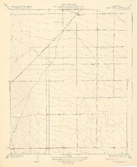
1932 Map of Delta Farms
USGS Topo · Published 1932About this map
Delta Farms is established across this flat agricultural stretch of Fresno County during the early 1930s, reflecting a period of highly organized industrial farming. The grid of the landscape is defined by an unusual naming convention for its thoroughfares, where major avenues take their names from early American automobile brands. Researchers will find Cadillac Avenue, Packard Avenue, Ford Avenue, and Stutz Avenue cutting straight lines across the valley floor.
Find a feature on this map
10 named features on this map. Tap any name to fly to it.
Don’t see what you’re looking for? This feature index may not catch every label — zoom into the map to look around manually.
Map Details
Editions of this 1932 Delta Farms Map
3 editions found
Other maps of this area

1912 · Coalinga
USGS Topo · 1:125,000

1928 · Delta Farms No 3
USGS Topo · 1:31,680

1931 · Wheatville
USGS Topo · 1:31,680

1931 · Towne Oil Station
USGS Topo · 1:31,680

1931 · Mouth of Cantua Creek
USGS Topo · 1:31,680

1932 · Delta Farms
USGS Topo · 1:31,680

1932 · West of Lethent
USGS Topo · 1:31,680

1933 · Huron
USGS Topo · 1:31,680

1933 · Guijarral Hills
USGS Topo · 1:31,680
1936 · Guijarral Hills
USGS Topo · 1:31,680