
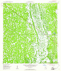
1950 Map of Delta
USGS Topo · Published 1950About this map
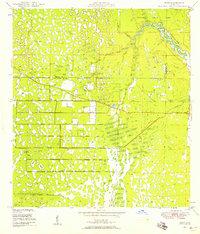
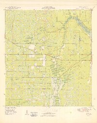
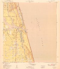
Loxahatchee Slough dominates this mid-century landscape, appearing as a complex network of wetlands and small upland islands before modern drainage and development reshaped the region. The map captures the area during a period of transition, where the natural hydrology of the Everglades still dictated the patterns of human movement. A solitary settlement, Delta, is positioned along the diagonal path of the Seaboard Air Line railroad. This rail corridor serves as the primary infrastructure cutting through the wet terrain, providing a vital link for transportation and commerce across the southern Florida interior. The presence of numerous bench marks along the track and throughout the slough reflects the precise surveying efforts by the Coast and Geodetic Survey to document this intricate environment for future reclamation and land use.
Find a feature on this map
5 named features on this map. Tap any name to fly to it.
Don’t see what you’re looking for? This feature index may not catch every label — zoom into the map to look around manually.
Map Details
Editions of this 1950 Delta Map
This is the sole edition of this map. No revisions or reprints were ever made.
Other maps of this area
1945 · Delta
USGS Topo · 1:24,000
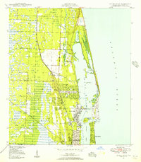
1946 · Riviera Beach
USGS Topo · 1:24,000
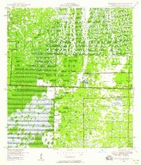
1946 · Palm Beach Farms
USGS Topo · 1:24,000
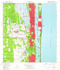
1946 · Palm Beach
USGS Topo · 1:24,000
1948 · Rood
USGS Topo · 1:24,000

1948 · Jupiter
USGS Topo · 1:24,000
1949 · Rood
USGS Topo · 1:24,000
1949 · Palm Beach Farms
USGS Topo · 1:24,000
1949 · Riviera Beach
USGS Topo · 1:24,000
1950 · Jupiter
USGS Topo · 1:24,000