
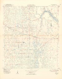
1949 Map of Rood
USGS Topo · Published 1949About this map
The Northwest Fork Loxahatchee River meanders through a landscape of wetlands and cypress strands at the border of Martin and Palm Beach counties. In this post-war environment, the small settlement of Rood sits near the center of the sheet, while the emerging Jupiter Corporation Limits are visible to the east. The terrain is defined by the expansive Loxahatchee Slough and a series of drainage projects, indicated by several segments of Levee. Local social life and education are represented by the Jupiter Sch, Mt Carmel Ch, and the Church of God. Distinctive landmarks such as the Trappers Zoo and an Indian Mound near Cypress Creek reflect the area's diverse history, from prehistoric habitation to early 20th-century Florida roadside attractions.
Find a feature on this map
14 named features on this map. Tap any name to fly to it.
Don’t see what you’re looking for? This feature index may not catch every label — zoom into the map to look around manually.
Map Details
Editions of this 1949 Rood Map
2 editions found
Other maps of this area

1945 · Delta
USGS Topo · 1:24,000

1946 · Riviera Beach
USGS Topo · 1:24,000

1948 · Rood
USGS Topo · 1:24,000

1948 · Gomez
USGS Topo · 1:24,000

1948 · Hobe Sound
USGS Topo · 1:24,000

1948 · Jupiter
USGS Topo · 1:24,000

1949 · Gomez
USGS Topo · 1:24,000

1949 · Riviera Beach
USGS Topo · 1:24,000

1949 · Hobe Sound
USGS Topo · 1:24,000

1950 · Jupiter
USGS Topo · 1:24,000