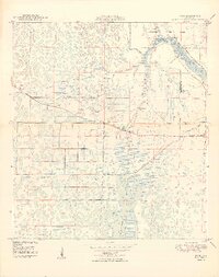
1949 Map of Rood
USGS Topo · Published 1949About this map
The Loxahatchee Slough dominates this 1940s landscape, illustrating the intricate wetland drainage patterns of northern Palm Beach County before extensive mid-century development. Central to the area is the settlement of Rood, situated near the county line where the land begins its transition toward the coast. To the east, the Northwest Fork Loxahatchee River winds through Jupiter State Park, a region marked by local landmarks like Trappers Zoo and an ancient Indian Mound.
Find a feature on this map
14 named features on this map. Tap any name to fly to it.
Don’t see what you’re looking for? This feature index may not catch every label — zoom into the map to look around manually.
Map Details
Editions of this 1949 Rood Map
2 editions found
Other maps of this area

1945 · Delta
USGS Topo · 1:24,000

1946 · Riviera Beach
USGS Topo · 1:24,000

1948 · Rood
USGS Topo · 1:24,000

1948 · Gomez
USGS Topo · 1:24,000

1948 · Hobe Sound
USGS Topo · 1:24,000

1948 · Jupiter
USGS Topo · 1:24,000

1949 · Rood
USGS Topo · 1:24,000

1949 · Gomez
USGS Topo · 1:24,000

1949 · Riviera Beach
USGS Topo · 1:24,000

1949 · Hobe Sound
USGS Topo · 1:24,000