
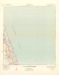
1949 Map of Hobe Sound
USGS Topo · Published 1949About this map
Jupiter State Park and the protected waters of Hobe Sound characterize this coastal landscape in the late 1940s. The topography reveals a narrow barrier system where Jupiter Island separates the Atlantic Ocean from the Intracoastal Waterway and the complex tidal channels of the Jupiter Narrows. Along the coast, established recreation and infrastructure are evident at the Jupiter Island Club, a Golf Course, and a US Coast Guard Station.
Find a feature on this map
29 named features on this map. Tap any name to fly to it.
Don’t see what you’re looking for? This feature index may not catch every label — zoom into the map to look around manually.
Map Details
Editions of this 1949 Hobe Sound Map
2 editions found
Other maps of this area

1948 · Rood
USGS Topo · 1:24,000

1948 · St. Lucie Inlet
USGS Topo · 1:24,000

1948 · Gomez
USGS Topo · 1:24,000

1948 · Hobe Sound
USGS Topo · 1:24,000

1948 · Jupiter
USGS Topo · 1:24,000

1949 · Rood
USGS Topo · 1:24,000

1949 · Gomez
USGS Topo · 1:24,000

1950 · St. Lucie Inlet
USGS Topo · 1:24,000

1950 · Jupiter
USGS Topo · 1:24,000

1956 · West Palm Beach
USGS Topo · 1:250,000