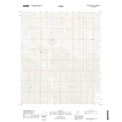
2018 Map of Demarcation Point A-1 SW
USGS Topo · Published 2018About this map
The British Mountains dominate this high-latitude terrain in the northern reaches of Alaska. This 2018 survey reveals a landscape defined by significant elevation changes and natural drainage patterns, notably where Joe Cr flows through the central valleys. To the east, the headwaters of Aspen Cr descend from the ridges. The map provides a precise view of the Public Land Survey System grid, including the intersection of t4s r44e, t4s r45e, t5s r44e, and t5s r45e. Lacking roads or permanent settlements, the area is documented here in its natural state, showing the complex contour lines of the mountain range as it appeared in the early 21st century.
Find a feature on this map
7 named features on this map. Tap any name to fly to it.
Don’t see what you’re looking for? This feature index may not catch every label — zoom into the map to look around manually.
Map Details
Editions of this 2018 Demarcation Point A-1 SW Map
This is the sole edition of this map. No revisions or reprints were ever made.
Other maps of this area

1951 · Demarcation Point
USGS Topo · 1:250,000

1951 · Table Mountain
USGS Topo · 1:250,000

1955 · Demarcation Point
USGS Topo · 1:250,000

1956 · Table Mountain
USGS Topo · 1:250,000

1964 · Table Mountain
USGS Topo · 1:250,000

1964 · Demarcation Point
USGS Topo · 1:250,000

1983 · Table Mountain D-2
USGS Topo · 1:63,360

1983 · Demarcation Point A-2
USGS Topo · 1:63,360

1983 · Table Mountain D-1
USGS Topo · 1:63,360
1983 · Demarcation Point A-1
USGS Topo · 1:63,360