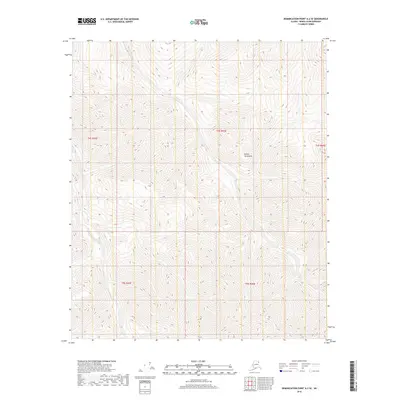
2018 Map of Demarcation Point A-2 SE
USGS Topo · Published 2018About this map
British Mountains define the physical geography of this remote Arctic interior, where the landscape is marked by high-altitude ridges and deeply incised drainage basins. This area of the North Slope represents a wilderness before significant industrial or infrastructure development, characterized by complex topographic contours that reflect the ancient geological folding of the range. The map details the Public Land Survey System grid, including boundaries for t4s r43e and t5s r44e, providing a precise record of the territorial divisions used for land management in this uninhabited northern reach.
Find a feature on this map
6 named features on this map. Tap any name to fly to it.
Don’t see what you’re looking for? This feature index may not catch every label — zoom into the map to look around manually.
Map Details
Editions of this 2018 Demarcation Point A-2 SE Map
This is the sole edition of this map. No revisions or reprints were ever made.
Other maps of this area

1951 · Demarcation Point
USGS Topo · 1:250,000

1951 · Table Mountain
USGS Topo · 1:250,000

1955 · Demarcation Point
USGS Topo · 1:250,000

1956 · Table Mountain
USGS Topo · 1:250,000

1964 · Table Mountain
USGS Topo · 1:250,000

1964 · Demarcation Point
USGS Topo · 1:250,000

1983 · Table Mountain D-2
USGS Topo · 1:63,360

1983 · Demarcation Point A-2
USGS Topo · 1:63,360

1983 · Table Mountain D-1
USGS Topo · 1:63,360
1983 · Demarcation Point A-1
USGS Topo · 1:63,360