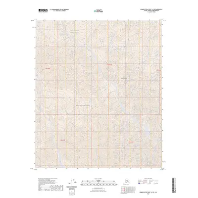
2023 Map of Demarcation Point A-2 SE
USGS Topo · Published 2023About this map
British Mountains dominate the landscape of this remote corner of the Alaska North Slope, where the terrain is characterized by steep elevation changes and intricate drainage patterns. The area is entirely encompassed by the Arctic National Wildlife Refuge, reflecting a high-latitude environment managed for preservation. Within these boundaries lies the Mollie Beattie Wilderness, a designation that highlights the lack of infrastructure and the persistence of a wild, unmodified landscape. The map provides precise topographic detail for northern peaks and valleys, illustrating a region defined by its geological formations rather than human settlement, where surveyor townships such as t4s r43e and t5s r44e partition the wilderness into a grid that exists largely on paper.
Find a feature on this map
8 named features on this map. Tap any name to fly to it.
Don’t see what you’re looking for? This feature index may not catch every label — zoom into the map to look around manually.
Map Details
Editions of this 2023 Demarcation Point A-2 SE Map
This is the sole edition of this map. No revisions or reprints were ever made.
Other maps of this area

1951 · Demarcation Point
USGS Topo · 1:250,000

1951 · Table Mountain
USGS Topo · 1:250,000

1955 · Demarcation Point
USGS Topo · 1:250,000

1956 · Table Mountain
USGS Topo · 1:250,000

1964 · Table Mountain
USGS Topo · 1:250,000

1964 · Demarcation Point
USGS Topo · 1:250,000

1983 · Table Mountain D-2
USGS Topo · 1:63,360

1983 · Demarcation Point A-2
USGS Topo · 1:63,360

1983 · Table Mountain D-1
USGS Topo · 1:63,360
1983 · Demarcation Point A-1
USGS Topo · 1:63,360