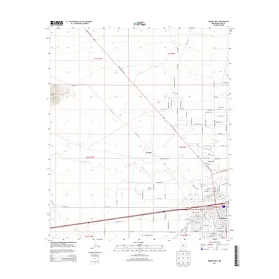
2013 Map of Deming West
USGS Topo · Published 2013About this map
Deming anchors the southeast corner of this survey, where the high desert meets a growing street grid defined by residential blocks and vital infrastructure. The Deming Cooling Tower and local Post Office stand near the main transit corridors, while the Mimbres River cuts a winding path across the central basin toward Peruhill. This landscape reflects a managed desert environment, evidenced by the Wamel Canal and a dense network of county roads like Florida Rd Sw and Hermanas Grade Rd Sw. In the northwest, the terrain rises sharply toward Black Mtn, providing a stark contrast to the flat valley floor. Local heritage is preserved at Holy Cross Cem, situated along Holy Cross RD NW just north of the city's outskirts, serving as a quiet landmark in the basin.
Find a feature on this map
120 named features on this map. Tap any name to fly to it.
Don’t see what you’re looking for? This feature index may not catch every label — zoom into the map to look around manually.
Map Details
Editions of this 2013 Deming West Map
This is the sole edition of this map. No revisions or reprints were ever made.
Other maps of this area

1899 · Deming
USGS Topo · 1:125,000

1915 · Deming
USGS Topo · 1:125,000

1955 · Las Cruces
USGS Topo · 1:250,000

1958 · Las Cruces
USGS Topo · 1:250,000

1964 · Goat Ridge
USGS Topo · 1:24,000
1964 · Spalding
USGS Topo · 1:24,000

1964 · Deming West
USGS Topo · 1:24,000

1964 · Massacre Peak
USGS Topo · 1:24,000
1964 · Williams Ranch
USGS Topo · 1:24,000

1965 · Deming East
USGS Topo · 1:24,000