
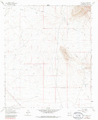
1964 Map of Goat Ridge
USGS Topo · Published 1967About this map
The historical Butterfield Trail cuts through the high desert of Luna County, tracing a legacy of mid-19th-century mail and passenger transport across this arid landscape. This mid-1960s survey captures the region's sparse infrastructure, where survival and movement were dictated by water sources like Mountain Well, Butterfield Well, and the Butterfield Windmill. To the south and east, the terrain rises into the distinctive formation of Goat Ridge and Fluorite Ridge, where localized Prospects indicate the area's mineral interest.
Find a feature on this map
18 named features on this map. Tap any name to fly to it.
Don’t see what you’re looking for? This feature index may not catch every label — zoom into the map to look around manually.
Map Details
Editions of this 1964 Goat Ridge Map
2 editions found
Other maps of this area

1899 · Deming
USGS Topo · 1:125,000

1915 · Deming
USGS Topo · 1:125,000

1955 · Las Cruces
USGS Topo · 1:250,000

1956 · Dwyer
USGS Topo · 1:62,500

1958 · Las Cruces
USGS Topo · 1:250,000

1962 · Lake Valley
USGS Topo · 1:62,500
1964 · Spalding
USGS Topo · 1:24,000

1964 · Deming West
USGS Topo · 1:24,000

1964 · Massacre Peak
USGS Topo · 1:24,000
1964 · Williams Ranch
USGS Topo · 1:24,000