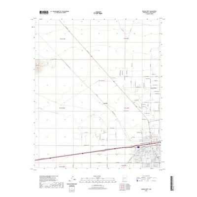
2020 Map of Deming West
USGS Topo · Published 2020About this map
Mimbres River drainage patterns define the desert floor west of Deming in this 2020 record of Luna County. The landscape is marked by a transition from the prominent elevation of Black Mtn in the northwest toward the structured grid of the modern town site. Settlement traces are evident at Peruhill and Keeler Farm, while the southern portion of the map captures the municipal expansion of the county seat, including the Luna County Judicial Complex.
Find a feature on this map
121 named features on this map. Tap any name to fly to it.
Don’t see what you’re looking for? This feature index may not catch every label — zoom into the map to look around manually.
Map Details
Editions of this 2020 Deming West Map
This is the sole edition of this map. No revisions or reprints were ever made.
Other maps of this area

1899 · Deming
USGS Topo · 1:125,000

1915 · Deming
USGS Topo · 1:125,000

1955 · Las Cruces
USGS Topo · 1:250,000

1958 · Las Cruces
USGS Topo · 1:250,000

1964 · Goat Ridge
USGS Topo · 1:24,000
1964 · Spalding
USGS Topo · 1:24,000

1964 · Deming West
USGS Topo · 1:24,000

1964 · Massacre Peak
USGS Topo · 1:24,000
1964 · Williams Ranch
USGS Topo · 1:24,000

1965 · Deming East
USGS Topo · 1:24,000