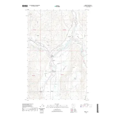
2020 Map of Deming
USGS Topo · Published 2020About this map
The North Fork Nooksack River and South Fork Nooksack River converge near Deming, defining a landscape of deep river valleys and high ridges in Whatcom County. Small settlements such as Welcome, Van Zandt, and Clipper follow the lowlands, connected by historic crossings like the North Fork Nooksack River Bridge and Potter Road Bridge. The topography is marked by dramatic features, including the Devils Slide and Van Zandt Dike, which rise sharply above the river plains.
Find a feature on this map
59 named features on this map. Tap any name to fly to it.
Don’t see what you’re looking for? This feature index may not catch every label — zoom into the map to look around manually.
Map Details
Editions of this 2020 Deming Map
This is the sole edition of this map. No revisions or reprints were ever made.
Other maps of this area

1906 · Sumas
USGS Topo · 1:62,500

1908 · Sumas
USGS Topo · 1:62,500

1918 · Samish Lake
USGS Topo · 1:62,500

1919 · Van Zandt
USGS Topo · 1:62,500

1921 · Wickersham
USGS Topo · 1:62,500

1951 · Wickersham
USGS Topo · 1:62,500

1951 · Van Zandt
USGS Topo · 1:62,500

1952 · Lake Whatcom
USGS Topo · 1:24,000

1952 · Lawrence
USGS Topo · 1:24,000

1952 · Sumas
USGS Topo · 1:24,000