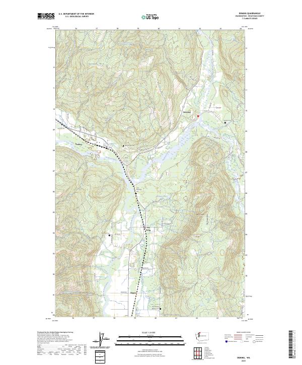
2023 Map of Deming
USGS Topo · Published 2023About this map
The confluence of the North Fork Nooksack River, the Middle Fork Nooksack River, and the South Fork Nooksack River defines this landscape in Whatcom County. These waterways create a low-lying valley corridor that supports a string of small settlements including Deming, Van Zandt, Welcome, and Clipper. The concentration of burial sites, such as the Saint Joseph Mission Cem, Mount Hope Cem, and Case Nooksack Cem, suggests a long-established rural community fabric linked by early logging or agricultural roads like Mosquito Lake Rd. The terrain is sharply bounded by significant topographical features, notably the Van Zandt Dike and the slopes of Suma's Mtn, which overlook the complex drainage systems of Hard Scrabble Falls Creek and Sygitowicz Creek. The mapping of small landmarks like Hard Scrabble Falls and Devils Slide provides a clear picture of the local geography within the T38N and T39N townships.
Find a feature on this map
63 named features on this map. Tap any name to fly to it.
Don’t see what you’re looking for? This feature index may not catch every label — zoom into the map to look around manually.
Map Details
Editions of this 2023 Deming Map
This is the sole edition of this map. No revisions or reprints were ever made.
Other maps of this area

1906 · Sumas
USGS Topo · 1:62,500

1908 · Sumas
USGS Topo · 1:62,500

1918 · Samish Lake
USGS Topo · 1:62,500

1919 · Van Zandt
USGS Topo · 1:62,500

1921 · Wickersham
USGS Topo · 1:62,500

1951 · Wickersham
USGS Topo · 1:62,500

1951 · Van Zandt
USGS Topo · 1:62,500

1952 · Lake Whatcom
USGS Topo · 1:24,000

1952 · Lawrence
USGS Topo · 1:24,000

1952 · Sumas
USGS Topo · 1:24,000