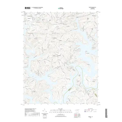
2019 Map of Demory
USGS Topo · Published 2019About this map
Norris Lake and the Powell River dominate the landscape of Campbell and Anderson Counties, where the complex shoreline of the reservoir reaches deep into the Appalachian ridges. The settlement of Demory sits at a crossroads of winding mountain lanes, while Grantsboro occupies a peninsula formed by the winding waters of the lake. This topography is defined by prominent elevations like Bald Knob and Tanbark Knob, separated by numerous namesake drainage basins including Stillhouse Hollow and Sugar Hollow.
Find a feature on this map
199 named features on this map. Tap any name to fly to it.
Don’t see what you’re looking for? This feature index may not catch every label — zoom into the map to look around manually.
Map Details
Editions of this 2019 Demory Map
This is the sole edition of this map. No revisions or reprints were ever made.
Other maps of this area

1893 · Briceville
USGS Topo · 1:125,000

1895 · Briceville
USGS Topo · 1:125,000

1896 · Briceville
USGS Topo · 1:125,000

1897 · Maynardville
USGS Topo · 1:125,000

1900 · Maynardville
USGS Topo · 1:125,000

1935 · Well Spring
USGS Topo · 1:24,000

1936 · Gorryton
USGS Topo · 1:48,000

1936 · Ivydell
USGS Topo · 1:24,000

1936 · Jacksboro
USGS Topo · 1:24,000

1936 · White Hollow
USGS Topo · 1:24,000