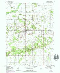
1957 Map of DeMotte
USGS Topo · Published 1987About this map
Kankakee River and Eagle Creek flow through this corner of Northwest Indiana, defining a landscape of agricultural drainage and reclaimed wetlands at the junction of Keener and Walker townships. The map highlights the town of Demotte, which grew around the intersection of regional roads and the Conrail line, alongside smaller rural hubs like Kersey and Kniman.
Find a feature on this map
36 named features on this map. Tap any name to fly to it.
Don’t see what you’re looking for? This feature index may not catch every label — zoom into the map to look around manually.
Map Details
Editions of this 1957 DeMotte Map
3 editions found
Other maps of this area

1953 · Leroy
USGS Topo · 1:24,000

1953 · Hebron
USGS Topo · 1:24,000

1953 · Kouts
USGS Topo · 1:24,000

1953 · Chicago
USGS Topo · 1:250,000

1957 · Chicago
USGS Topo · 1:250,000

1957 · Wheatfield
USGS Topo · 1:24,000

1957 · DeMotte
USGS Topo · 1:24,000

1959 · Shelby
USGS Topo · 1:24,000

1962 · Gifford
USGS Topo · 1:24,000

1962 · Parr
USGS Topo · 1:24,000