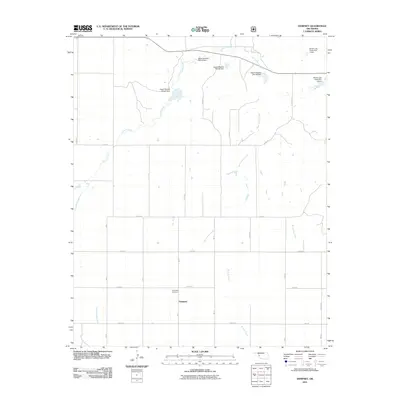
2011 Map of Dempsey
USGS Topo · Published 2011About this map
Dempsey is situated in a landscape defined by the drainage basins of the southern plains, where numerous creek branches and water management structures shape the geography. This 2011 survey by the U.S. Geological Survey shows a network of local roads including N 1780 Rd and E 1030 Rd that partition the land into a traditional section-line grid. Significant to local history and genealogy is the Dempsey Cemetery, located just north of the settlement.
Find a feature on this map
32 named features on this map. Tap any name to fly to it.
Don’t see what you’re looking for? This feature index may not catch every label — zoom into the map to look around manually.
Map Details
Editions of this 2011 Dempsey Map
This is the sole edition of this map. No revisions or reprints were ever made.
Other maps of this area

1955 · Clinton
USGS Topo · 1:250,000

1957 · Clinton
USGS Topo · 1:250,000

1960 · Sweetwater
USGS Topo · 1:62,500

1960 · Cheyenne
USGS Topo · 1:62,500

1960 · Sayre
USGS Topo · 1:62,500

1961 · Reydon
USGS Topo · 1:62,500

1984 · Foss Reservoir
USGS Topo · 1:100,000

1985 · Elk City
USGS Topo · 1:100,000
1988 · Grimes
USGS Topo · 1:24,000

1988 · Dempsey
USGS Topo · 1:24,000