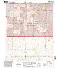
1998 Map of Dempsey
USGS Topo · Published 2001About this map
Black Kettle National Grassland dominates the northern half of this landscape, reflecting a conservation legacy administered by the Forest Service across Roger Mills County. The terrain is characterized by the branching drainages of Croton Creek and East Croton Creek, while the southern portion transition into the agricultural and ranching zones of the Meridian and Berlin townships. At the heart of the southern plains lies the small settlement of Dempsey, which serves as a vital anchor for local genealogy with its adjacent Dempsey Cem. This 1990s revision reveals an economy shaped by natural resource extraction, indicated by numerous dispersed Gas Wells and Drill Holes that punctuate the prairie alongside landmarks like the Townhall.
Find a feature on this map
18 named features on this map. Tap any name to fly to it.
Don’t see what you’re looking for? This feature index may not catch every label — zoom into the map to look around manually.
Map Details
Editions of this 1998 Dempsey Map
This is the sole edition of this map. No revisions or reprints were ever made.
Other maps of this area

1955 · Clinton
USGS Topo · 1:250,000

1957 · Clinton
USGS Topo · 1:250,000

1960 · Sweetwater
USGS Topo · 1:62,500

1960 · Cheyenne
USGS Topo · 1:62,500

1960 · Sayre
USGS Topo · 1:62,500

1961 · Reydon
USGS Topo · 1:62,500

1984 · Foss Reservoir
USGS Topo · 1:100,000

1985 · Elk City
USGS Topo · 1:100,000
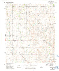
1988 · Grimes
USGS Topo · 1:24,000

1988 · Dempsey
USGS Topo · 1:24,000