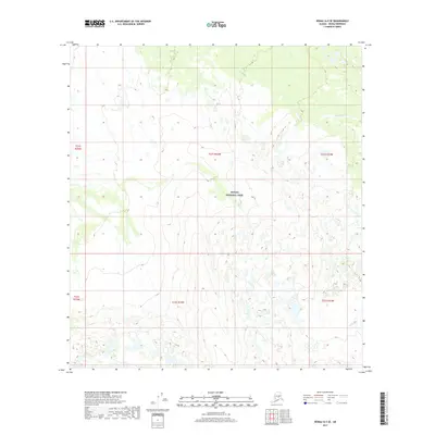
2017 Map of Denali A-5 SE
USGS Topo · Published 2017About this map
Denali National Park encompasses the vast majority of this interior Alaskan landscape, which is characterized by intricate river systems and glacial drainages. Seasonal watercourses like Dry Cr and the larger Highpower Cr dominate the northern and central sections of the quadrangle, illustrating the complex hydrology of the Denali Borough. The map detail highlights the dramatic transition between high-elevation terrain and the wetland basins below. While largely wilderness, the inclusion of legal boundaries such as t21s r24w and t22s r24w provides a necessary structural framework for understanding the public land survey system within one of the nation's most famous protected areas.
Find a feature on this map
9 named features on this map. Tap any name to fly to it.
Don’t see what you’re looking for? This feature index may not catch every label — zoom into the map to look around manually.
Map Details
Editions of this 2017 Denali A-5 SE Map
This is the sole edition of this map. No revisions or reprints were ever made.
Other maps of this area

1950 · Talkeetna
USGS Topo · 1:250,000

1951 · Talkeetna
USGS Topo · 1:250,000

1952 · Mount McKinley
USGS Topo · 1:250,000

1952 · Mount McKinley A-5
USGS Topo · 1:63,360

1953 · Mount McKinley A-4
USGS Topo · 1:63,360

1954 · Mount McKinley A-4
USGS Topo · 1:63,360

1954 · Mount McKinley A-5
USGS Topo · 1:63,360

1958 · Talkeetna D-5
USGS Topo · 1:63,360

1958 · Talkeetna D-4
USGS Topo · 1:63,360

1958 · Talkeetna
USGS Topo · 1:250,000