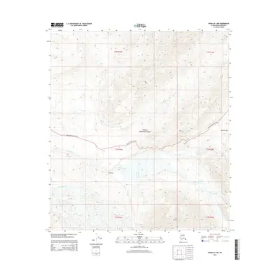
2015 Map of Denali B-1 NW
USGS Topo · Published 2015About this map
Mt Eielson and Mt Galen anchor the high-altitude interior of Denali National Park, where glacial runoff feeds a complex network of braided rivers. The McKinley River and Thorofare River dominate the lowlands, collecting drainage from numerous named tributaries like Glacier Cr, Camp Creek, and Sunrise Creek. This 2015 survey illustrates the infrastructure supporting access to these subarctic landscapes, centered on the Denali National Park Road. Historically significant routes and pathways, including the Alpine Trail and Tundra Trail, trace the contours near Thorofare Pass, providing a window into the established movement patterns through this protected corridor. The map further identifies geological points of interest such as The Notch and the confluence of Gorge Creek within the rugged drainage basins.
Find a feature on this map
29 named features on this map. Tap any name to fly to it.
Don’t see what you’re looking for? This feature index may not catch every label — zoom into the map to look around manually.
Map Details
Editions of this 2015 Denali B-1 NW Map
This is the sole edition of this map. No revisions or reprints were ever made.
Other maps of this area

1952 · Mount McKinley
USGS Topo · 1:250,000

1952 · Mount McKinley B-2
USGS Topo · 1:63,360

1952 · Mount McKinley B-1
USGS Topo · 1:63,360

1952 · Mount McKinley C-1
USGS Topo · 1:63,360

1952 · Mount McKinley C-2
USGS Topo · 1:63,360

1954 · Mount McKinley C-1
USGS Topo · 1:63,360

1954 · Mount McKinley B-1
USGS Topo · 1:63,360

1954 · Mount McKinley B-2
USGS Topo · 1:63,360

1954 · Mount McKinley C-2
USGS Topo · 1:63,360

1958 · Mount McKinley
USGS Topo · 1:250,000