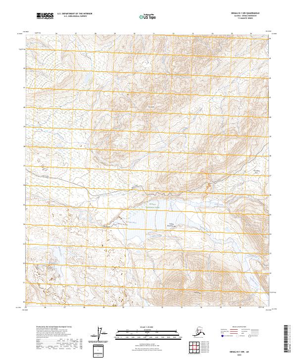
2023 Map of Denali B-1 NW
USGS Topo · Published 2023About this map
Denali National Park and the expansive Denali Wilderness dominate this interior Alaska landscape, centered on a high-altitude drainage system. The terrain is defined by the winding course of the Thorofare River and the McKinley River, which are fed by numerous tributaries including Grant Creek and Sunrise Creek. The only significant human engineering is the Park Road, which traverses the center of the sheet, crossing through Thorofare Pass. Significant peaks such as Mt Galen to the north and Mt Eielson to the south overlook the glacial outwash of Copper Mountain Bar. This area, surveyed for modern topographic accuracy, illustrates the complex hydrology of the Alaska Range where small seasonal flows like Contact Creek and Gorge Creek carve through the mountain passes.
Find a feature on this map
24 named features on this map. Tap any name to fly to it.
Don’t see what you’re looking for? This feature index may not catch every label — zoom into the map to look around manually.
Map Details
Editions of this 2023 Denali B-1 NW Map
This is the sole edition of this map. No revisions or reprints were ever made.
Other maps of this area

1952 · Mount McKinley
USGS Topo · 1:250,000

1952 · Mount McKinley B-2
USGS Topo · 1:63,360

1952 · Mount McKinley B-1
USGS Topo · 1:63,360

1952 · Mount McKinley C-1
USGS Topo · 1:63,360

1952 · Mount McKinley C-2
USGS Topo · 1:63,360

1954 · Mount McKinley C-1
USGS Topo · 1:63,360

1954 · Mount McKinley B-1
USGS Topo · 1:63,360

1954 · Mount McKinley B-2
USGS Topo · 1:63,360

1954 · Mount McKinley C-2
USGS Topo · 1:63,360

1958 · Mount McKinley
USGS Topo · 1:250,000